I’ve created a new page on the blog called Roadtrip USA so that all of these posts are organized and easily accessible in one place. It even has a fun clickable map like the London page, so you can follow along and watch our trail progress! I’ll be adding posts to the map as they go up, but if you want to see our entire itinerary, you can find it HERE.
I did a little interview feature with a travel community site called Bohemian Birds – check it out here.
Now back to the good stuff!
I know I waxed poetic about leaving the desert for the mountains when we entered Colorado, but we had one last desert adventure up our sleeves! After our jaunt through Telluride and a much-needed steam in the hot springs of Ouray, we dipped our toes back into Utah for an afternoon.
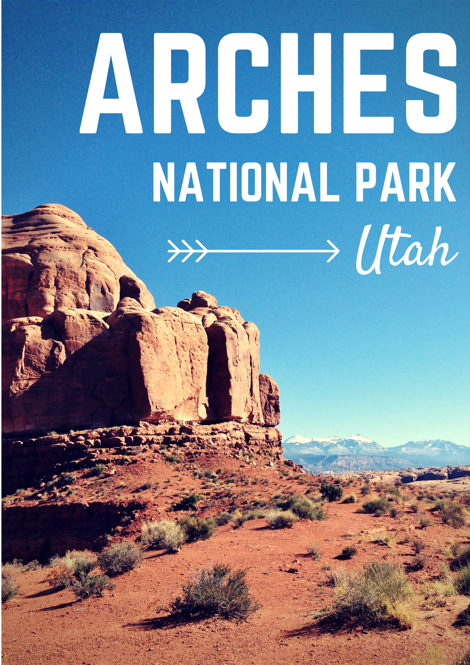
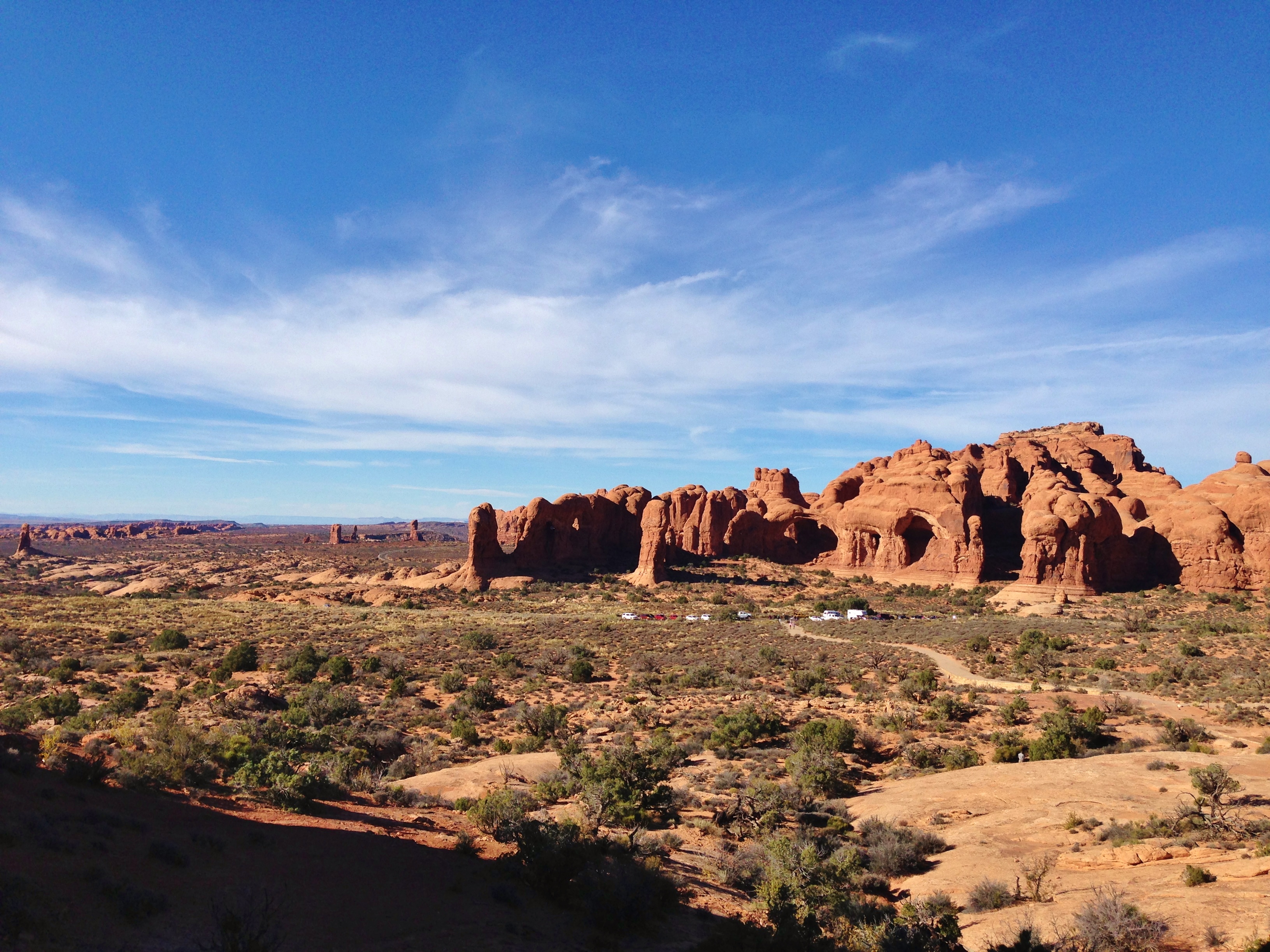
Destination? Arches National Park, a “red rock wonderland” outside of Moab and home to over 2000 naturally-formed sandstone arches. It was hot and dry without a cloud in the sky (rhyme – heyo!) and, as was the pattern during this off-season trip, there were very few other visitors in the park with us.
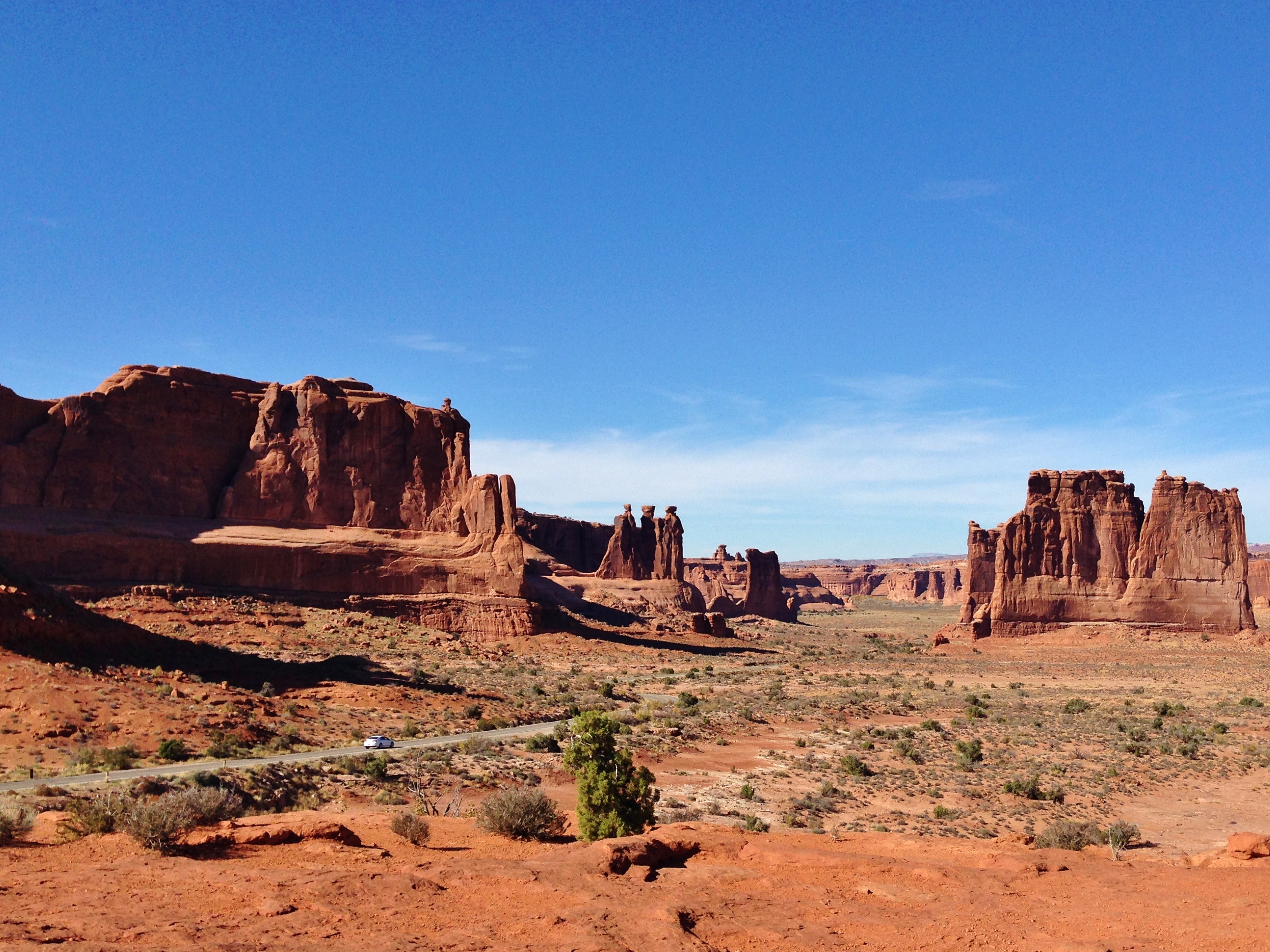
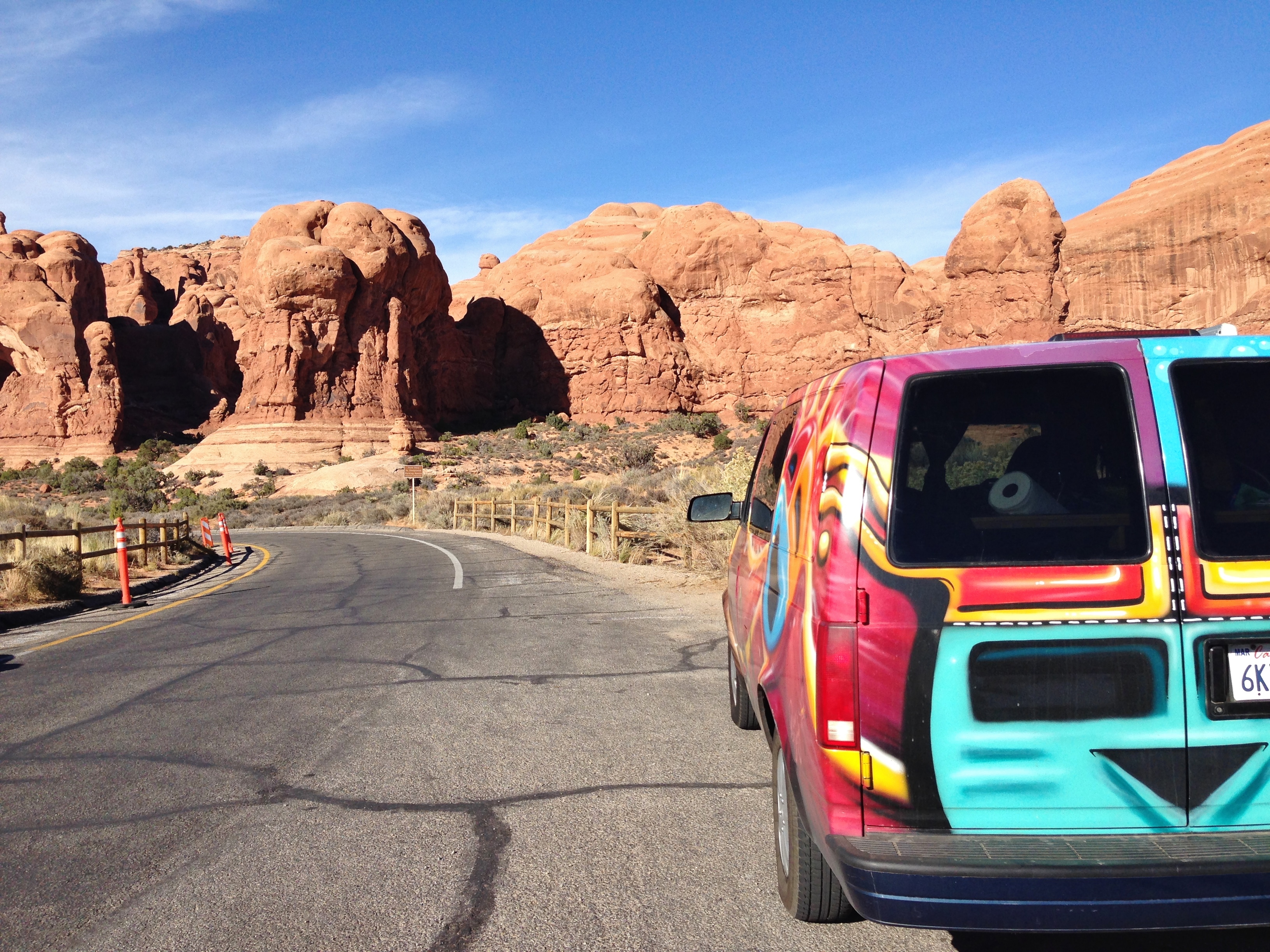
We meandered our way (in Kokapelli, of course) along the twisting main road, stopping for quick side walks whenever something struck our fancy.
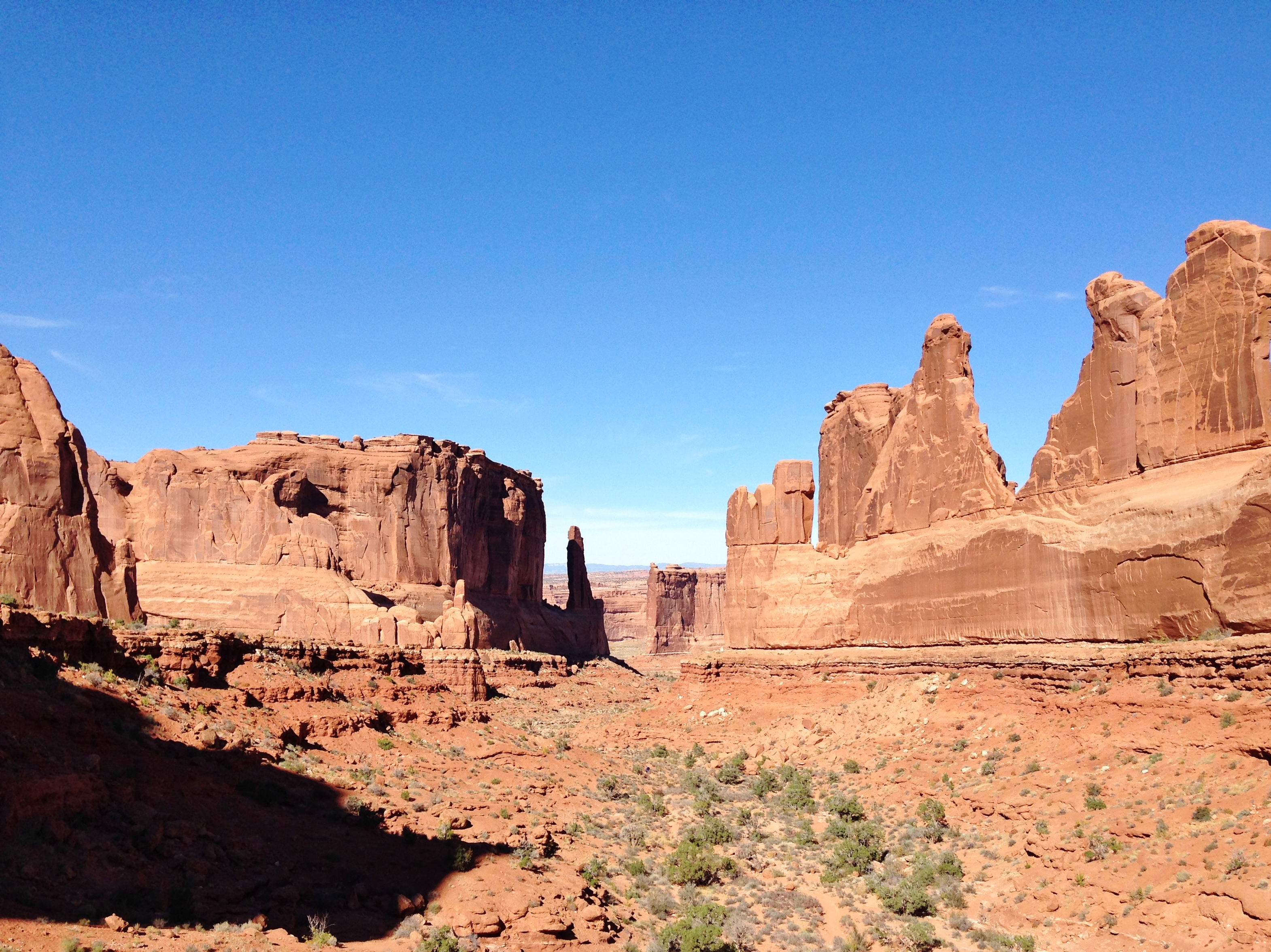
Though the arches are the namesake and the main draw of the park, the place is home to plenty of other amazing geological features carved into the red sandstone, named imaginatively for more familiar structures they resemble. The National Park Service website has a great explanation of the science behind the formation of arches here.
The Three Gossips (center) and Courthouse Towers (right):
Balanced Rock:
I’m told (by Wikipedia) that the upper rock is about as big as three school buses!
The natural sandstone structure is so precarious that, inevitably, it will someday fall (as will all of the arches). There’s something sort of poetic about understanding and accepting how temporary everything in this park is (cheesy but true?).
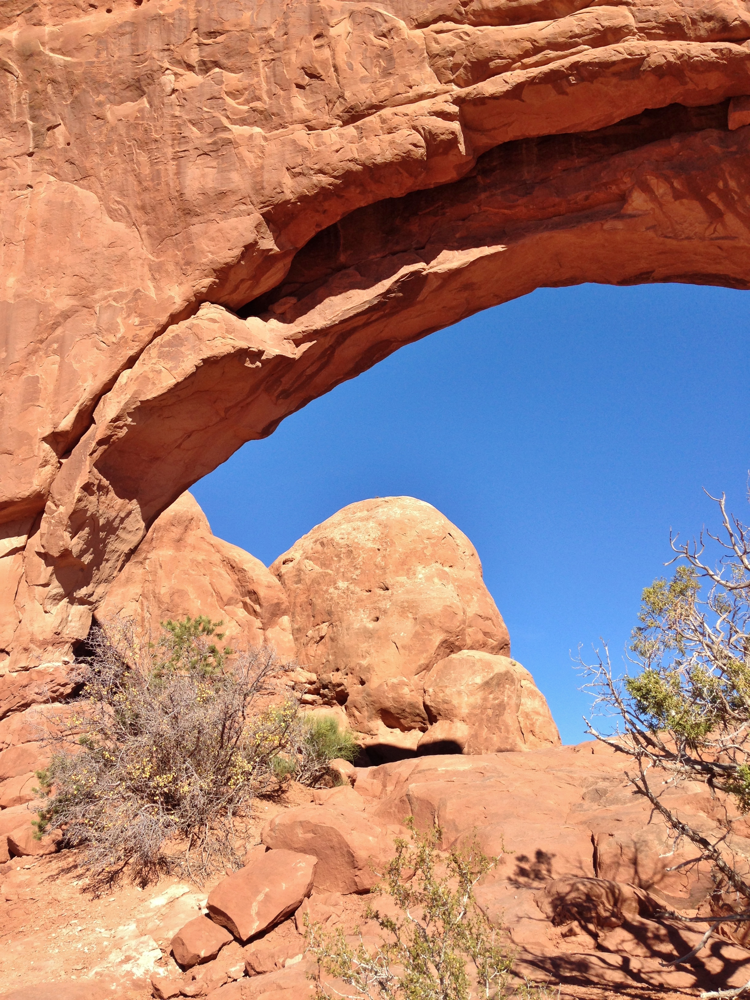
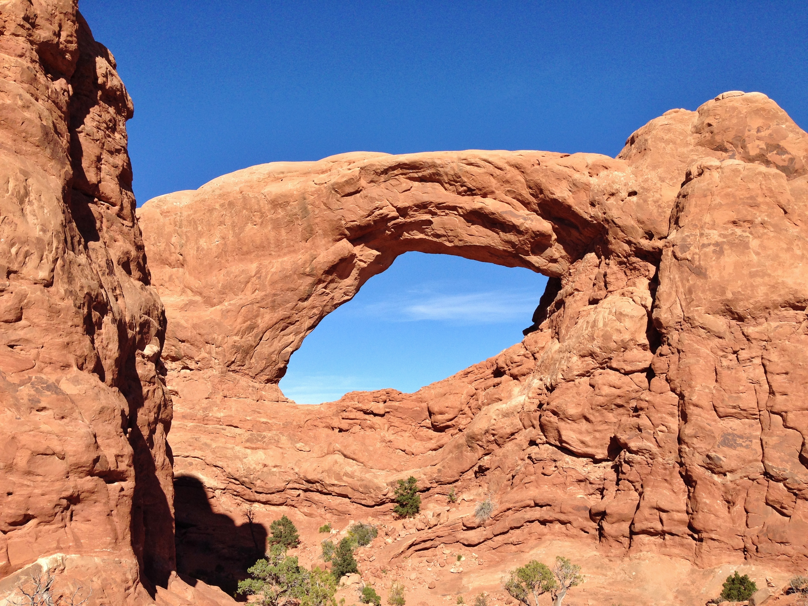
North and South Window (confession time: I don’t remember which is which):
Turret Arch:
And of course, the main event – Delicate Arch, a.k.a. Cowboy Chaps:
There is another hiking trail which will take you right up to the base of Delicate Arch and give you a vantage point to get those epic NatGeo-esque photos (see here), but we had plans to get back across the Colorado border before nightfall (and the sun was pretty blistering), so we had to opt out of that side trek.
We did make a little friend in the Delicate Arch parking lot, though.
Though there are literally thousands of arches and features to explore throughout the nearly eighty thousand acres of the park, the main impression I got was of vast emptiness.
I love the contrast of the flat red plains with snowcapped peaks way off in the distance. The epitome of “wide open spaces,” eh?
The last view we had as we approached the exit was of the Fiery Furnace, growing redder as the sun dipped lower.
Another win for the NPS, I’d say! Next time, we’re back in Colorado and on to more mountain adventures.
The Details: $10 entry fee per vehicle | Open year-round | Website HERE
It was both the beginning of our amazing roadtrip adventure and a quintessential part of it. Images of deserts, canyons, and red rocks were the foundation for our initial roadtrip daydreams, and we didn’t let go of them. It was the landscape that was most foreign to me and one of the most uniquely beautiful and interesting because of it.
Following the fulfillment of all my cowboy aspirations in Monument Valley, we sliced up through the Four Corners (postcard coming soon!) and into colorful Colorado.
Hold on, I feel a tangent coming on. Why are the state line “Welcome to Colorful Colorado” signs completely brown? Is it supposed to imply that the state is so colorful that it speaks for itself? Because the Colorado state signs were by far the most boring of any we saw. Tsk tsk.
Luckily the place itself far surpasses the expectations set by the sad little signs. I hadn’t been to Colorado since I was a toddler (and I don’t remember that trip at all), but I instantly felt at home. I loved every state we visited for different reasons, but Colorado was the first one that made me think, “I could actually stay here.”
We didn’t get far that first evening, but stopped just inside the southwest corner in the little town of Cortez. This was our first introduction to the weather shift between the desert and the mountains, as it got down into the 20s that night (that’s rough in a house and even worse in a van). Luckily, this was the day that we gained an addition to our little vagabond family in the form of the warmest, softest blanket I have ever experienced. Go to your nearest Walmart right now and just look for a blanket with a pattern of pinecones. Unfortunately I can’t be any more specific than that except to ensure you that it’s heavenly.
Having made it through the night quite comfortably thanks to our fluffy bundle of joy, we started the next morning at my favorite coffee shop of the trip: the Silver Bean.
There was a lot of personality and top notch java stuffed inside that battered old Airstream! The two baristas were hustling like crazy and churning out lattes as though they had way more than 20 square feet of space to work with.
With coffee and breakfast in hand, we hopped back into Kokapelli and set off for Mesa Verde, our destination for the morning.
Mesa Verde National Park is just a short drive outside of Cortez in Montezuma County. The area was inhabited by the Ancient Pueblo (Anasazi) peoples from roughly 600-1300 AD. Unlike many of the more nomadic Native American cultures, they stayed in this area for centuries and built extensive cliff dwellings which have been incredibly well preserved.
The road to the park led us on a winding path up through the hills. You don’t get a sense of it from these photos, but there were a few switchbacks as we spiraled up and around that reminded me forcefully of that old Mickey Mouse cartoon where he hitches up his trailer and takes a disastrous mountain drive with Goofy and Donald (this one <— go watch it!). This was the first time I really related to that cartoon on our roadtrip, but it certainly wouldn’t be the last.
See the Rockies way off on the horizon there? I loved having mountains like that back within view. And take a gander at that skyyyy…
We made it to the Chapin Mesa Archaeological Museum and met up with the first guided tour group of the day. Usually, Mesa Verde has a whole bunch of amazing sites to explore; however, our timing gave us limited options. There was a winter stormfront set to move through in the next few days so temperatures had plummeted, and there is currently extensive preservation work being carried out on Cliff Palace, the largest and most well-known cliff dwelling, so that’s temporarily closed to visitors.
On the bright side, we had fewer agonizing decisions to make about cutting things out to stick to a schedule, and were able to take advantage of everything Mesa Verde had to offer that day! We joined a walking tour of Spruce Tree House, the third largest village in the park. See it peeking out from under the cliff tabletop there?
Now, guys. Let’s talk about tour guides. You know I love ‘em. I most recently waxed poetic about Broderick in Antelope Canyon, as well as his dynamic predecessors, Billy and Ernest of Edinburgh. So let me now introduce you to the latest and greatest (well, it’s at least a tie) in our cast of tour guide characters: Terrapin.
You’ll direct your attention to his footing, if you please. He chose to give the tour introduction while basically hanging on to the steep rockface by his toes.
Terrapin was one of the most genuine souls I have ever encountered. Not only did he fill us in on the fascinating history of Spruce Tree House and the ancient tribes who lived there, but he also told us about his own lifelong aspiration to become a park ranger at Mesa Verde, the time he’d spent as a young boy with his father and brothers in the area, and his own children’s growing interest in the park. It was amazing to be shown around by someone who was so strongly and personally connected to the area; this relatively small, 80-square-mile park in Colorado was clearly his place more than anywhere else in the world. I loved that.
We made our way down the steep hillside path and right up to Spruce Tree House, which is actually comprised of about 130 rooms throughout the long village dwelling.
Terrapin described the discovery and subsequent archeological and anthropological study of the cliff dwellings, explaining that researchers have been able to discern details such as the number of families that lived in each dwelling and which rooms were used for cooking, sleeping, etc. Even hundreds of years later, the carbon from cooking fires is easily visible on the underside of the cliff.
Here’s a fun fact about me: I love superlatives. I think my friend Erika was the first one to actually point this out, when she asked me during our New Zealand roadtrip why I was so keen on stopping at the steepest street in the world, the only castle in the southern hemisphere, and the southernmost Starbucks in the world. There’s just something exciting about places that are truly one of a kind!
Anyway, Mesa Verde has a lot going for it in this department. Aside from being a beautiful national park and an UNESCO World Heritage Site, it’s the largest archeological preserve in the United States and contains the largest cliff dwelling in all of North America (Cliff Palace).
My favorite Mesa Verde superlative, though, is that it is the ONLY cultural park in the United States National Park System – meaning it’s the only one preserving historic man-made structures instead of purely natural landscapes.
I found the architecture of the dwellings so impressive. The walls looked almost like they’d been pre-built and then wedged perfectly under the cliff face, although they were constructed in place brick by brick. The Anasazi originally built their dwellings on the flat, grassy tops of the mesas, but eventually moved down as their populations grew and they recognized the protection that the rock overhang could offer.
One of the coolest features of Spruce Tree House that we were able to experience was visiting a kiva, one of the circular underground rooms that were used for religious ceremonies. We descended the ladder through the tiny hole and into the dark kiva (certain replacements/reinforcements have been made for safety reasons, but the location and general structure are still original) and got a glimpse into one of the most important rituals in the lives of the original inhabitants of Mesa Verde.
Ascending the ladder from the dark kiva after a ceremony represented the Ancient Pueblo peoples’ legend of their ancestors emerging from the previous world into the current one. It was pretty special to be able to follow in such meaningful footsteps!
I tried to soak up every word that Terrapin said (including when he proudly announced that he has never owned a cell phone), but I’m sure I lost out on a few things as I wandered around the cliff dwellings peeking through windows and doorways.
After giving one of the best tours in living memory, Terrapin made his only fatal mistake by telling our group that the surrounding area was actually full of tarantulas. BYE.
Amity and I hightailed it back up the pathway, made a quick second pass through the museum to get our National Park Passport stamps, and carried on.
After all, the mountains were calling!
The Details: $10 entry fee per vehicle | Open year-round with occasional weather closures | Website HERE
Ah, the Grand Canyon. The Big One. The feature that has launched a thousand roadtrips and crowned a thousand bucket lists.
You usually imagine this, right?
Vast rocky cliffs and gorges stretching into the desert farther than you can see.
The Grand Canyon itself lives up to that expectation… and exceeds it, for that matter. It was the drive through the outskirts of the national park and up to the main attraction that really surprised me.
After exploring the amazing Zion and Bryce Canyon National Parks, Amity and I spent the night in the tiny blink-and-you’ll-miss-it town of Kanab, Utah, just a couple of miles from the Arizona border. It was another one of those incredible wake-up calls where we’d arrived at our destination in pitch darkness and woken up the next morning surrounded by towering red rock cliffs (plateaus? mesas? I really need to brush up on my geology lingo).
We set off south on the 80-mile drive to the Grand Canyon, most of which is rugged wilderness that’s part of the larger Grand Canyon National Park. This is what I mean when I said that it surprised me:
This is just not what I picture when I imagine Arizona. First of all, it was freezing! The wind was cold and snow was flurrying on and off – but it was still bright and sunny and a very pretty drive.
The closer we got to the Canyon, the more I kept expecting the snow to stop, the pine trees to fade away, and the desert to appear… but the landscape looked like that right up until we pulled into the parking lot at Point Imperial and caught a glimpse of this through the trees.
The rock spire in the foreground of that photo is Mount Hayden, one of the most unique features at Point Imperial and apparently a popular spot for free climbers (no thanks).
We had Point Imperial completely to ourselves. There wasn’t another soul in sight, which was frankly magical. As if I haven’t said it enough already, I will forever be singing the praises of late fall/early winter as the best time to visit national parks.
Point Imperial is the northernmost overlook on the Grand Canyon’s North Rim, so you can really see everything. The view puts every Pinterest photo and IMAX movie you’ve ever seen to shame. I’d been a little apprehensive that the GC was going to be one of those iconic sights that is so overhyped that it ends up being a little underwhelming when you finally see it for yourself. That, my friends, was not the case.
One of my good friends from London takes empty bench photos. I loved that creative photography theme and I’ve started texting these to her whenever I find a seat in a great location. It somehow makes it easier to imagine yourself back in that spot, and it’s sort of special to think about all the people who may have sat there in the past. It’s a good example of travel broadening your horizons and making you more aware of your surroundings.
We left Point Imperial and drove a little further into the park, heading towards the North Rim Visitor Center. The building itself was closed for the winter by this time, but it still boasts some incredible lookout spots. The trees were still so thick here that we only gradually started getting glances of the canyon as we walked from our van to the edge.
I hadn’t really been aware that there was such a difference between the North Rim and the South Rim of the Grand Canyon before our visit. The South Rim cuts through the dry, hot, and amazingly flat Arizona desert, while the North Rim drops away unexpectedly in the midst of acres of dense pine forests and wild hills. The South Rim is over a thousand feet lower in elevation than the North Rim, the temperature is generally warmer (meaning it almost never has seasonal or weather closures), and it’s more easily accessible (an hour or two outside of Flagstaff, a major city). All these factors combine to make the South Rim the much more frequently visited side of the Grand Canyon.
However, even though the North Rim and South Rim Visitor Centers are only about ten miles apart… those ten miles are across the canyon (I know, I’m dropping major knowledge on you here, folks). Amity and I were coming from the north and didn’t want to spend the time and mileage driving allllll the way around the canyon, so North Rim it was for us.
My mom and brother visited the South Rim a few years ago, so I just had my brother’s photos of horse trekking across the flat sandy desert to the canyon’s edge in my head. Even though both sides seem to offer a unique and surprisingly different experience, I was glad we visited the more secluded North Rim.
I think my reasoning is self-explanatory:
Another thing I was (perhaps naively) surprised about was how little it looked like the single huge canyon I had pictured in my mind’s eye. The deep, prominent gash you see in some of these photos is actually Bright Angel Canyon, which is carved by Bright Angel Creek and runs perpendicular to the main canyon and the Colorado River. Bright Angel and Roaring Springs (seen in the photo directly above with that crazy cool tree) are only two of the massive network of gorges of all different sizes that make up the entire Grand Canyon National Park system.
I found another empty bench, and one that just looked too lonely to leave empty any longer.
Amity and I braved the treacherous pathway out to Bright Angel Point (only tiny stone borders between you and a pretty scary drop-off).
…before heading back along the path in the other direction to take in the view from every angle.
The bright midday sun coupled with the thick clouds rolling past threw parts of the landscape into deep shadows while others were lit up golden, and the colors seemed to change almost constantly.
We were also extremely lucky with visibility – there was a sign saying that sometimes it gets so hazy that you can’t see the far side of the canyon.
About this time, we had a kindly stranger offer to take our photo for us, which we gladly accepted… but he immediately began coaching us into a dramatic side-by-side pose in which we both looked wistfully over the canyon, “taking in the majesty.” It was a very sweet gesture to be sure, but just resulted in a series of photos in which we’re looking slightly confused and/or trying not to laugh, and the Grand Canyon itself doesn’t even quite make it into the frame.
Good for a laugh and another story for the roadtrip bank, anyway! And we got a nice one later on.
Having filled our eyeballs and adventurous hearts pretty near saturation, we saddled back up in Kokapelli and ventured on to our next destination. I would love to visit the South Rim and check out the desert someday, but for now, I’m totally #TeamNorthRim. Who’s with me?
THE DETAILS: $25 entry fee per vehicle | North Rim open mid-May through Oct/Nov (variable); South Rim open year-round | Website HERE